
The Undercliff Walk runs 3 miles under the cliffs, the Chattri loop 5.3 miles. 12 walks near Brighton with distances, buses, parking, dogs and toilets.
The walks most people near Brighton start with are Devil’s Dyke, the National Trust’s dry valley north of Hove; the Undercliff Walk from the Marina to Saltdean; Ditchling Beacon, the highest point in East Sussex; and Stanmer Park. Every entry was checked against the council’s, National Trust’s or National Park’s own pages on 26 October 2026.
We have not graded these routes and nothing here is a ranking. Each entry sets out what Brighton & Hove City Council, the National Trust, the South Downs National Park Authority and Rottingdean Parish Council publish: distance, time, surface, gates and stiles, dogs, buses, parking and toilets. Most of the downland routes cross working farms with sheep or cattle, and the council asks for dogs on a lead or under close control on all of its walks.
Along the coast
The Undercliff Walk, Brighton Marina to Saltdean
A path along the foot of the chalk cliffs, part of the city’s coast defences and shared by walkers and cyclists. The council’s Undercliff Walk page gives it as just over 5km, about 3 miles, from behind Asda in Brighton Marina to the city boundary at Saltdean. Ramps lead down from the east end of Madeira Drive, the cliff road opposite Roedean Café, the south end of Rottingdean High Street, the subway opposite Saltdean Lido and the cliff road opposite Longridge Avenue, and there are steps at Ovingdean Gap. Public toilets and cafes are at the Marina, Ovingdean Gap, Rottingdean and Saltdean. The council warns that waves come over the sea wall at high tide in rough weather and that chalk and flint fall from the cliffs; it closes parts of the path when the cliffs are unstable, and no closure was posted on 26 October.
Saltdean to Rottingdean over the Downs
The council’s Walk 2 is the inland half of a day on the coast: 3.3 miles, about an hour and a half, from the 27 Coaster stop at the top of Saltdean Vale shops, up a bridleway past Pickershill Farm and over the downland to Rottingdean. It comes down Whiteways Lane, a tree-lined lane the council dates to the 1700s and links with smuggling, to the High Street, where the 2, 2a and 22 buses stop. Surfaces are farm tracks rutted in places, grass and short stretches of tarmac, with bridleway gates and no stiles mentioned. Toilets, cafes and pubs are at both ends, and the Undercliff Walk joins the two villages along the shore for the way back.
Beacon Hill Nature Reserve and the windmill, Rottingdean
The hill above Rottingdean with the village’s windmill on top, a Local Nature Reserve since 2004 and inside the South Downs National Park. Rottingdean Parish Council’s reserve page says the windmill went up in 1803 and opens over some summer weekends; a 2017 extension took in the former pitch and putt course and added 8.15 hectares. Most of the reserve is open access land, crossed by three bridleways (from Sheepwalk to the south, from Hog Plat and the recreation ground to the north, and towards Longhill Road in Ovingdean) and several footpaths, so walks of any length are possible. Skylarks nest here: the parish council asks for dogs under control and on the paths, and on a lead in the sheep enclosure.
East Brighton and the eastern Downs
Sheepcote Valley to Ovingdean
The council’s Walk 5 is a 4-mile circuit of about an hour and 50 minutes from the Downland Road stop on Warren Road (buses 2 and 22), by the Warren Road car park. It climbs Sheepcote Valley for views across the city to the sea, then loops round by Ovingdean Grange Farm on farm tracks, grass paths and a short tarmac stretch of Old Parish Lane. Expect bridleway, field and double gates, and a short track across East Brighton golf course, where the council asks walkers to take care. There are no toilets or cafes on the route: the council points to the toilets at Lawn Memorial Cemetery and the cafes in Woodingdean.
Castle Hill National Nature Reserve, Woodingdean
Castle Hill is a National Nature Reserve of ancient chalk grassland, with orchids and butterflies at their best in spring and summer. The council’s Walk 4 circles it in 4.9 miles, about two hours ten, from the Downs Hotel stop in Woodingdean (buses 2, 22, 72a and N1). It uses farm tracks rutted in places, gravel and a terraced grass track along the steep hillside, with bridleway gates throughout, and returns past the car park on Falmer Road, which needs crossing with care. There is no public toilet in Woodingdean. For a gentler outing, the council’s Woodingdean to Ovingdean trail is 1.2 miles downhill on a paved path along Old Parish Lane, with two bridleway gates and buses 52 and 91 back from Wanderdown Road.
North of the city
Stanmer Park
An 18th-century landscape on the edge of the National Park, with Grade I listed Stanmer House, the estate village, woodland and One Garden Brighton in the old walled garden. The council’s Walk 8 is a 4.1-mile loop of about an hour and 50 minutes from the Hollingbury Asda stop on Crowhurst Road (buses 5b, 24, 26, 52 and 55); it opens with a steep embankment, which the 79 to Upper Lodges car park avoids. Within the park the council signposts a Woodland Walk, the longest of three, plus a Historic Walk and a Monument Walk. Toilets are by Stanmer Tea Rooms in the village (BN1 9PZ), at the Circa kiosk by the Lower Lodges entrance and in One Garden. For wheels, the Stanmer Greenways trail runs 0.75 miles up from the 78 stop at the park gates on compacted gravel. Our directory has Stanmer Tea Rooms and Circa in the Park; we also reported on the heritage study of the park.
Wild Park and Hollingbury hillfort
The council describes Wild Park, off Lewes Road (BN1 9JS), as the city’s largest Local Nature Reserve, grazed by sheep and always open. At the back of the park a steep slope known as the “ski slope” climbs to Hollingbury Fort, an Iron Age hillfort, for views over the city, and trails run on through Hollingbury Woods; the council publishes an easy-access trail leaflet for the woods on its Wild Park page. The council’s smartphone walks page maps the hilly 2.4-mile Hollingbury Healthwalk through the woods, the hillfort and Wild Park from the children’s centre on Brentwood Road. The Pavilion Cafe opens 7.30am to 2.30pm on weekdays and 8.30am to 2.30pm at weekends; the toilets open daily from 10am to 4pm.
The Chattri, from Patcham
The Chattri stands on the Downs above Patcham where Hindu and Sikh soldiers who died in Brighton’s war hospitals in 1914 to 1918 were cremated, according to the South Downs National Park Authority. The council’s Walk 9 reaches it in a 5.3-mile loop of about two hours twenty from the bus stop outside the Ladies Mile pub (buses 5 and 5a), past Standean Farm and Horsedean Recreation Ground. Surfaces are rutted farm tracks, grass and a long tarmac section on the Standean Farm road, with bridleway gates and no stiles mentioned. There are no public toilets on the route; the Ladies Mile is at the start. A short loop is also published as Walk 10.
Ditchling Beacon and the Jack and Jill windmills
At 248 metres, Ditchling Beacon is the highest point in East Sussex, with the remains of an Iron Age hillfort, cared for by the National Trust, with views to the sea and across the Weald. The National Park’s Miles Without Stiles leaflet has two circular routes from the free car park at the Jack and Jill windmills, which has a height barrier: 5.7 miles (9.2km) taking in the Beacon, and 4.5 miles (7.2km) along the South Downs Way and down the Sussex Border Path to the Chattri. Both have some steep gradients and loose stone and mud in winter, but no steps or stiles. The Trust asks for dogs on leads at all times at the Beacon, where parking costs £1.50 for an hour to £6 all day (members free); its nearest toilets are in Ditchling village. The 79 bus runs on Sundays and bank holidays all year, and Saturdays in summer.
West of the city
Devil’s Dyke
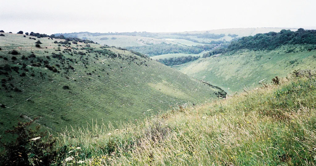
The National Trust says the valley is nearly a mile long and the longest, deepest and widest dry valley in the UK; John Constable called the view “the grandest view in the world”. Iron Age ramparts and the remains of a Victorian funfair are a few minutes from the car park. The National Park’s Devil’s Dyke circular, 2 to 3 miles and one to two hours, drops from the bus stop by the Devil’s Dyke pub (BN1 8YJ) through woodland to Poynings and the Royal Oak, then climbs back through the valley bottom; it has one stile, several gates and a steep wooded track that is slippery when wet. Parking is £1.50 for an hour to £6 all day, free for members and Blue Badge holders, and free at Summer Down Road. Dogs must be on leads where signs show grazing livestock. The 77 runs from the station and pier daily in summer, and on winter weekends and bank holidays only, never on Christmas Day.
Hangleton to Devil’s Dyke on the old railway line
The council’s Walk 12 reaches the Dyke from the city on foot: 5.6 miles, about two and a half hours, from the Hardwick Road stop (buses 5, 5a and 5b). The first part follows the Dyke Railway Trail, the tarmac bed of a branch line that ran from 1887 to 1938, and can be walked out and back on a hard surface; the rest is grass, bridleways and farm tracks past a dew pond and the hillfort ramparts. There are several gates and one squeeze stile, and walkers follow blue arrows across the golf course. No public toilets; the council lists a cafe at Brighton & Hove Golf Club. Its 2.4-mile Walk 13 is a shorter, one-hour loop on the same line.
Hove Park
For a short, easy walk in the city, the council’s 1.2-mile Hove Park Healthwalk starts at the entrance to Hove Park Cafe and circles the 40-acre park, with open grass, mature trees, flower beds and sculpture. The council lists Hove Park among its six Green Flag parks and maps the route on its smartphone walks page. Its free Healthwalks run led group walks in parks around the city, from under a mile on the flat to 5 miles on the more challenging routes.
How we chose
These are the walks people near Brighton search for, chosen from what the path owners publish, not on taste. We started with the council’s Venture Out bus walks and walk guides, the National Trust’s pages for Devil’s Dyke and Ditchling Beacon, and the South Downs National Park’s routes, then added Beacon Hill from Rottingdean Parish Council. We left out routes we could not check on an owner’s page. Distances and times are the publishers’ own and vary between sources: the National Park gives the Devil’s Dyke circular as 2 to 3 miles, for example. Everything was checked on 26 October 2026. Bus timetables thin out in winter, so check buses.co.uk before you set out.
Run a place that should be here, or spot something that has changed? Email newsdesk@brightontimes.co.uk.
For somewhere to eat or drink after a walk, see our guides to Brighton pubs, Sunday roasts, Brighton cafes and Brighton restaurants. For more ideas, see things to do in Brighton, what’s on in Brighton this month and parking in Brighton, or browse the pubs and cafes in our Brighton business directory.
Frequently asked questions
Which walks near Brighton can you do by bus?
Each of the council’s Venture Out walks in this guide starts at a bus stop: the Chattri loop from the Ladies Mile pub (buses 5 and 5a), Castle Hill from the Downs Hotel stop in Woodingdean (2, 22, 72a and N1), and the Stanmer loop from Hollingbury Asda (5b, 24, 26, 52 and 55). The 77 runs to Devil’s Dyke and the 79 to Ditchling Beacon, both less often in winter.
Are there walks near Brighton for wheelchairs and pushchairs?
The council’s Stanmer Greenways trail is 0.75 miles of compacted gravel and tarmac that it calls ideal for wheeled users, and its Woodingdean to Ovingdean trail is 1.2 miles of paved path with two bridleway gates. The South Downs National Park’s two Ditchling Beacon and Chattri routes have no steps or stiles and were tested on class 3 all-terrain mobility scooters.
How much does it cost to park at Devil’s Dyke?
The National Trust charges £1.50 for an hour, £3 for up to two hours, £4 for up to four hours and £6 all day at the Devil’s Dyke car park. National Trust members and Blue Badge holders park free, and parking at Summer Down Road is free. Ditchling Beacon has the same charges.
Have your say